


The Void Went Flash
Liberty Quinn's solo exhibition at Hackney Gallery looks at how technology and climate change intersect through images captured from Google Earth.
Focusing on Antarctica, a region deeply affected by climate change, Quinn screenshots moments where Google Earth's portrayal of the ice continent’s surface as faultless and pristine breaks down, either due to glitches in Google’s algorithm or the ravaging effects of global warming.
These moments at once reveal how Google Earth constructs its images by combining decades of satellite data into a seamless illusion of an Earth without rotation, clouds or weather systems, and explores the artificiality of this representation and its ecological implications. In the artist’s own words, “It is almost as if when a technological glitch occurs, an ice sheet melts”.
Presenting the screenshots using audio-visual and printing technologies, Quinn brings viewers back to the digital source of viewing, aspiring to correct what she considers the sensory abstraction of satellite images and processes of acceleration, to instead - through virtual proximity and a slowing down of the viewer’s perception - allow us to reflect on alternative temporalities and durations.
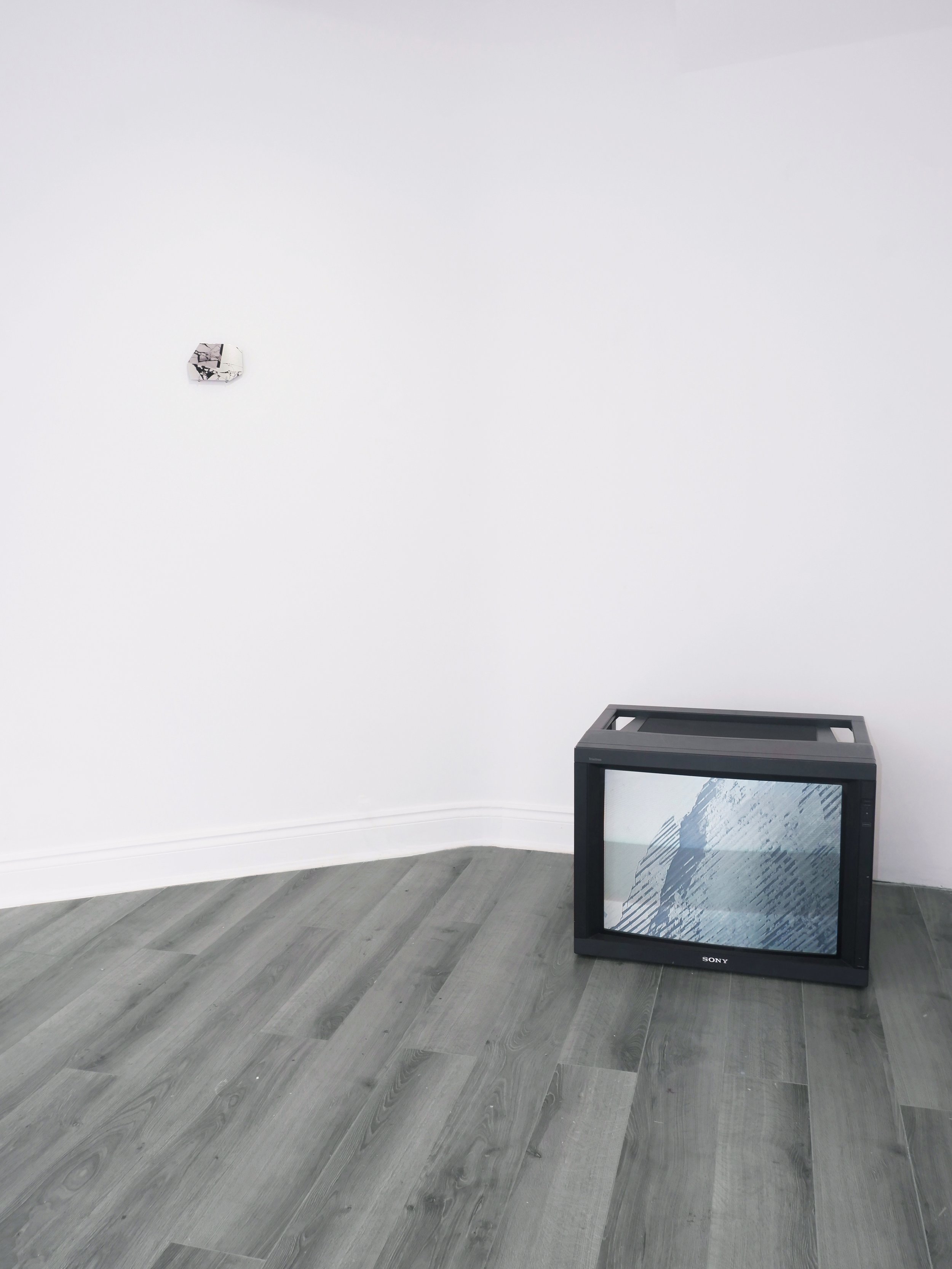
Against the gallery’s back wall, a CRT monitor displays the video work Temporal Lapse, a time-lapse over a certain point in Antarctica from 1984 until the present day. Through using media technologies to record changes that take place slowly over time, Quinn illustrates the slow violence of the Anthropocene era, and how its rhythms of transformation operate well below the threshold of human’s temporal sensitivity.
Positioned centrally on the gallery’s floor, Pixel Displace explores the formalities within the breakdowns of Google Earth imaging, and how it relates to the planet’s ecology through screenshotting instances ofice becoming pixels. Presenting them as UV prints on large sculptural pieces of aluminium, Quinn recalibrates them through sculpture to visualise in 3D the fragmentation of ice sheets, while the use of fibre optic cable references the speeds of data in which she uses to access the remote location of Antarctica.
To the right, Perimeter shows satellite imagery captured around the continent's perimeter, an area with the highest levels of human activity and ice sheet movement. The work’s configuration on the wall subtly alludes to Antarctica’s jagged perimeter, where elements never quite align and are constantly in flux. Meanwhile, the deliberate absence of certain 'pixels' mimics the scarcity of information in this remote locale, shedding light on the challenges of data collection. Additionally, images crossing across 'tiles' are reminiscent of data transmission across networks.
Words by Francesca Dobbe.
Image credit Lakshita Munjal.